


04/03/2011
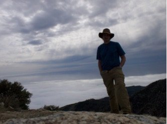
Cone peak stands at 5155’ above sea level, but is only 3 miles away from the ocean.
04/03/2011
Cone peak stands at 5155’ above sea level, but is only 3 miles away from the ocean.
11/06/2010
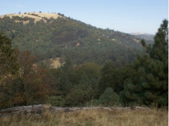
My quest was pretty simple. Wander up through the Joseph D. Grant county park and see what I could find. The reality turned out to be quite a little trip. The day started at the east side of the park off of 130 at the Twin Gates trail head. The beginning elevation was 2400’. There I followed the Canada de Pala trail north up to the Pala Seca Trail. Here I veered off all the way until I hit Antler point at 2,999 feet. Feeling a little brazen (and probably dumb), I wandered down into the valley below to see the stream below, Hondo Arroyo Creek. Suddenly I was treading down a pretty steep muddy hill. This was a mistake. At the bottom, there didn’t look like a good way to get up on either side, so I wandered up the creek a little and was able to find a gentle grade on the other side to climb up.

08/28/2010
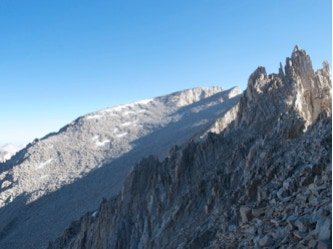
We showed up at the ranger station right at 8am to test our luck at getting the chance of taking one of the other 40% of 10 slots (4 slots) to go up Shepherds pass. Thankfully, the permit gods were on our side and by 10am we were at the trailhead beginning our long haul. I nimbly hiked the first pretty flat part, crossing the Symmes Creek four times without getting wet. Irene on the other hand trudged through, dropping her feet into the stream at each crossing. After a mile or so, we hit the steep ascent up the bottom of Mt. Bradley. Three quarters of the way up we stopped to catch a breath, even our pace, and eat lunch. We finally hit the saddle a little after 1pm and began our traverse around the ridge bordering Shepherds creek. The traverse had some significant descending sections, which was disheartening after such a long ascent to get to the saddles. On the inner side of each bowl we traversed, there were cute shaded streams, allowing us access to water and a little shade. 3~4 miles later we reached the main waterfall on the Shepherds creek and Mahogany flat.. Here there were light fields and it was sometimes confusing which trail to take as some led to campsites.
07/17/2010
The trip started with the long 6+ hour trek from San Jose all the way to Whitney Portal with a quick stop at the ranger station to pick up the permit. We camped Friday night at the trailhead in the backpacker camp. In the morning we began our first day hiking up to Trail camp at 9:30am. We wandered through the basin and had lunch at mirror-lake around 1pm. After Eric took a quick dip and Ben and I took a 20-minute nap, we were back on the trail and finally hit Trail camp at 4:30. The 10 mile hike had only taken us about 8 hours. Eric wandered off to boulder around, while Ben and I were dealing with altitude as we had been mildly sick a week before.

06/14/2010
The lost coast is a stretch of coastline in northern California between Mattole and Shelter cove. The hike is 24 miles or so of mostly untouched coast. Plus if you get bored, you can hike to the tip of King’s peek, 4008 feet above sea level where you start ... at sea level. To get a better idea on location, think of the redwood forests and then go north 50 miles and 22 miles to the sea.